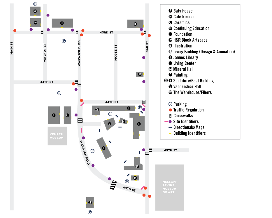
Map, Concept, and Integrating Technology
By Erika Goering,
Filed under: KCAI, Learning, Spatial Experience
Comments: Comments Off on Map, Concept, and Integrating Technology
Jessie Ren and I have made quite a bit of progress since last week.
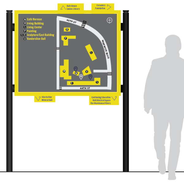
We’ve updated our map to be easier to read and easier to use for our mockups.
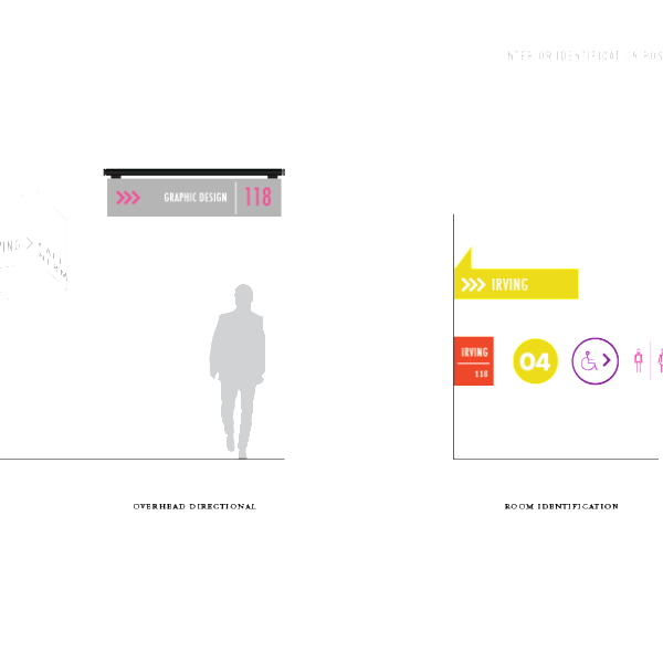
 We’ve been developing an icon set for our wayfinding system. Icons will be used for identifying places within the context of the map, and for wayfinding elements in the space itself.
We started to mock up some signage ideas too. We want to juxtapose the history of KCAI with the idea of KCAI’s pioneering and bold nature.
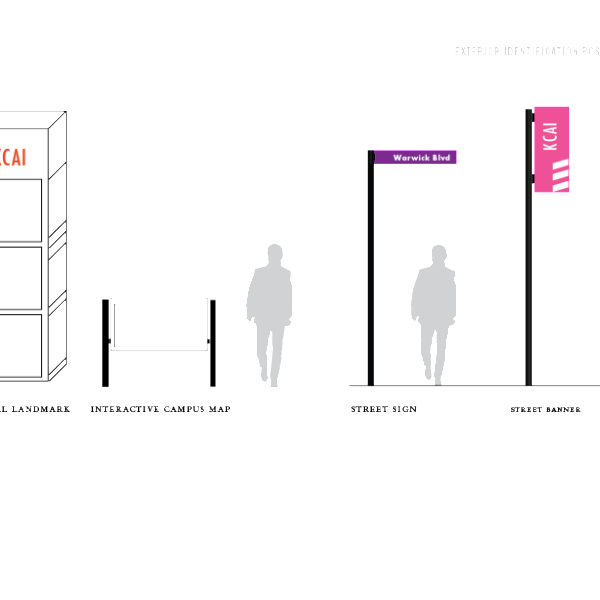
We’ve also been discussing the possibility of integrating technology into the wayfinding experience. Interactive maps would display dynamic content, such as campus alerts, event information, and even a walk-time calculator that shows how how long it takes to get to a certain place on campus (this is helpful for students or visitors who need to make a trek to another part of campus in a short amount of time).
This is an example of the walk-time thing:

The point of using technology in the wayfinding experience is to further push the idea of juxtaposing the old/historic characteristics of KCAI with the progressive and innovative nature of the students here.
We really want to utilize dimensionality in a way that neither of us have ever thought about before (hooray for branching out!). We want to make wayfinding elements like directionals flow around corners and utilize how people walk along hallways and forked paths. We want to take advantage of how people use the space to provide solutions to common wayfinding problems.